Peleaga peak
24 August 2019
For our last hiking day, we aim for the Peleaga Peak, the highest peak in the mountains at 2509 m.
| Pietrele Chalet (1480m) – Gentiana Chalet (1680m) – Bordul Tomii (1888m) – Lake Pietrele (1990m) – Bucura Saddle (22070m) – Crusta Bucurei Saddle (2307m) – Peleaga Peak (2509m) ) – Lake Bucura (2040m) – Lake Bucurelu (2070m) – Bucura Saddle- Pietrele Chalet |
| Time with rest: 11 hours Distance: 18 km Level difference: 1200 m Difficulty: difficult alpine hike |
For our last hiking day, we aim for the Peleaga Peak, the highest peak in the mountains at 2509 m. To see as much of the mountains as possible, we set off on a different pathway than the day before, so we headed up the Pietrele Valley.
From the Pietrele Chalet, we followed the yellow triangle mark ![]() in the woods, and soon we reached an intersection, where we switched to the blue triangle mark
in the woods, and soon we reached an intersection, where we switched to the blue triangle mark![]() , which we only followed for a shorter section. We changed the mark again, at the next intersection and turned to the red cross mark
, which we only followed for a shorter section. We changed the mark again, at the next intersection and turned to the red cross mark![]() . Simply, we always turned to the path that led up.
. Simply, we always turned to the path that led up.
The red cross mark led to the Gentiana Chalet.


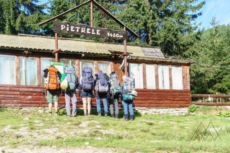
A Gentiana Chalet is situated at 1670 m, also in a central area, a 45-minute walk from Pietrele Chalet. For your accommodation, it is also advisable to inquire about availability before arrival. Food and drink can also be bought in the cabin.
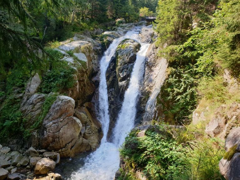
Further from the chalet, we followed the blue lane mark![]() . We passed near the Pietrele waterfall, the huge rock called Bordul Tomii, the Pietrele glacier lake, after which we only walked on rocks.
. We passed near the Pietrele waterfall, the huge rock called Bordul Tomii, the Pietrele glacier lake, after which we only walked on rocks.


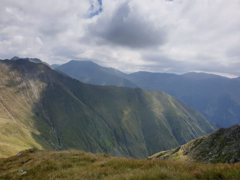
After a steep catch, we ascended the saddle of Bucura, 2206m high, when the other side of the saddle unfolded before us: in the depths of the big valley, there was the largest lake in the Retezat Mountains, Lake Bucura and on the shore were many tents.


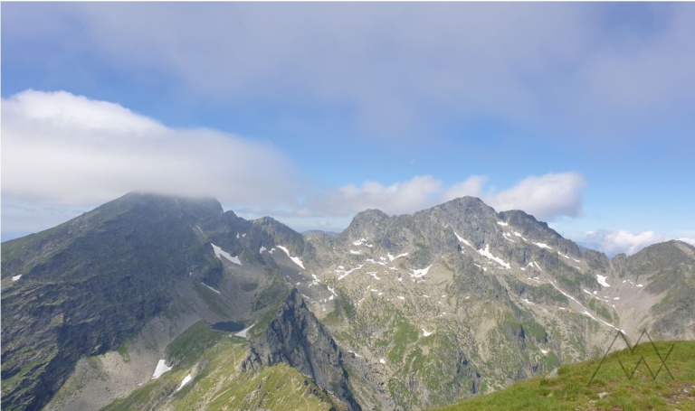
From here, we continued on the red lane mark![]() , which first reached the summit of Crusta Bucurei. The “path” led through a “sea of stones”, where we didn’t even see the pathway many times, we just headed in the direction and made our way forward.
, which first reached the summit of Crusta Bucurei. The “path” led through a “sea of stones”, where we didn’t even see the pathway many times, we just headed in the direction and made our way forward.


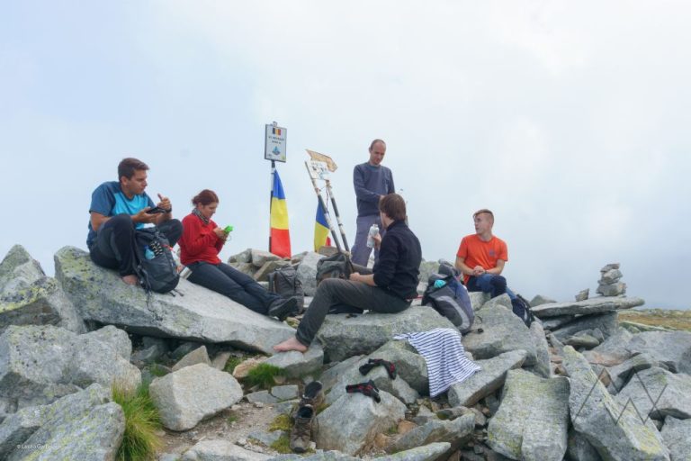
The trail to the top of Peleaga led to the ridge, where we had to be very careful at every step, hiding several dangerous sections especially near the top, the so-called Coltii Pelegi, where we had to cling well to the stones so as not to fall down.


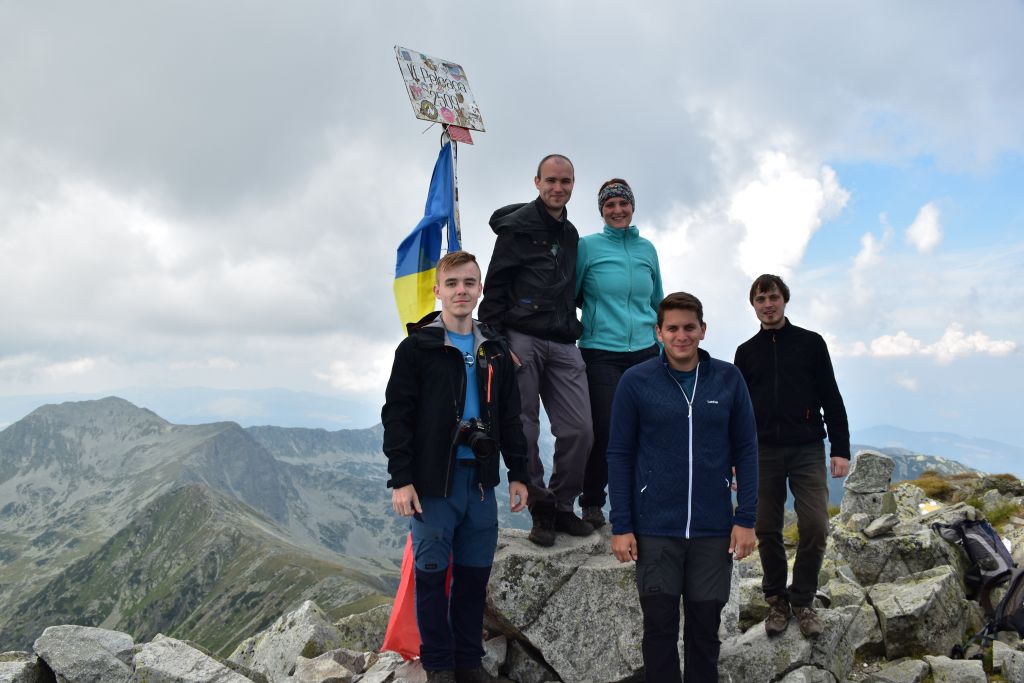
And finally we reached the 2509 m high Peleaga peak. This was my first peak conquest of more than 2,500 m height. Drunk from endorphins, we figured out, to make a detour and return to the saddle by bypassing Lake Bucura. After a little rest and a lot of photos, we also started following the yellow cross mark![]() jelzést követve.
jelzést követve.


USEFUL INFO: Near the lake, where we descend on the yellow lane mark, near Salvamont, there is a spring of potable water.
USEFUL INFO: You can camp at Lake Bucura. Unfortunately, nowadays there are those who do not care about nature and do not respect it. Whenever we go out into nature, we need to respect those around us, always leave cleanliness to ourselves, and never leave litter.


From the lake, we headed back to the saddle at the blue lane mark![]() , from where we hiked back down the trail to Pietrele Chalet, stopping at the Gentiana chalet for a festive beer.
, from where we hiked back down the trail to Pietrele Chalet, stopping at the Gentiana chalet for a festive beer.
In the evening we crowned the day with a divine can of beans and then put ourselves away for the next day.
Strava:
Wikilok:
Some photos are made by my friends: Balogh László, Balogh Tamás, Dinnyés Ádám József, Nagy Csaba.